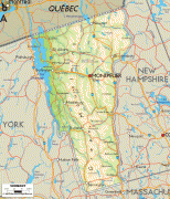
Vermont
 |
 |
For some 12,000 years, indigenous peoples have inhabited this area. The competitive tribes of the Algonquian-speaking Abenaki and Iroquoian-speaking Mohawk were active in the area at the time of European encounter. During the 17th century, French colonists claimed the territory as part of the Kingdom of France's colony of New France. After the Kingdom of Great Britain began to settle colonies to the south along the Atlantic coast, the two nations competed in North America in addition to Europe. After being defeated in 1763 in the Seven Years' War, France ceded its territory east of the Mississippi River to Great Britain.
Thereafter, the nearby British Thirteen Colonies, especially the provinces of New Hampshire and New York, disputed the extent of the area called the New Hampshire Grants to the west of the Connecticut River, encompassing present-day Vermont. The provincial government of New York sold land grants to settlers in the region, which conflicted with earlier grants from the government of New Hampshire. The Green Mountain Boys militia protected the interests of the established New Hampshire land grant settlers against the newly arrived settlers with land titles granted by New York. Ultimately, a group of settlers with New Hampshire land grant titles established the Vermont Republic in 1777 as an independent state during the American Revolutionary War. The Vermont Republic abolished slavery before any of the other states.
During the mid-19th century, Vermont was a strong source of abolitionist sentiment, although it was also tied to King Cotton through the development of textile mills in the region, which relied on southern cotton. It sent a significant contingent of soldiers to participate in the American Civil War.
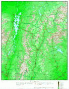
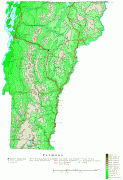
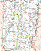
The geography of the state is marked by the Green Mountains, which run north–south up the middle of the state, separating Lake Champlain and other valley terrain on the west from the Connecticut River valley that defines much of its eastern border. A majority of its terrain is forested with hardwoods and conifers, and a majority of its open land is devoted to agriculture. The state's climate is characterized by warm, humid summers and cold, snowy winters.
Vermont's economic activity of $34 billion in 2018 ranked last on the list of U.S. states and territories by GDP but 34th in GDP per capita. In 2000, the state legislature was the first to recognize civil unions for same-sex couples. , the state ranked 14th on the American Human Development Index.
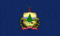
Samuel de Champlain claimed the area around what is now Lake Champlain, giving the name Vert Mont (Green Mountain) to the region he found, on a 1647 map. Evidence suggests that this name came into use among English settlers, before it morphed to "Vermont", ca. 1760. In 1777, Thomas Young introduced the name in writing with a broadside "To the Inhabitants of Vermont, a Free and Independent State".
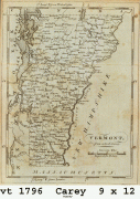
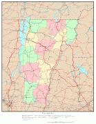
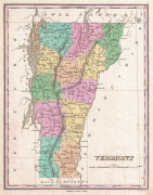
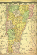
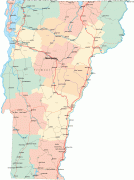
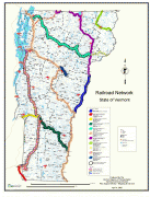
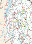
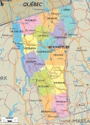
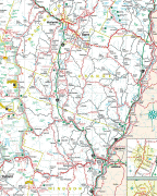
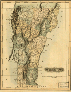
Map - Vermont
Map


Country - United_States
 |
 |
| Flag of the United States | |
Indigenous peoples have inhabited the Americas for thousands of years. Beginning in 1607, British colonization led to the establishment of the Thirteen Colonies in what is now the Eastern United States. They quarreled with the British Crown over taxation and political representation, leading to the American Revolution and proceeding Revolutionary War. The United States declared independence on July 4, 1776, becoming the first nation-state founded on Enlightenment principles of unalienable natural rights, consent of the governed, and liberal democracy. The country began expanding across North America, spanning the continent by 1848. Sectional division surrounding slavery in the Southern United States led to the secession of the Confederate States of America, which fought the remaining states of the Union during the American Civil War (1861–1865). With the Union's victory and preservation, slavery was abolished nationally by the Thirteenth Amendment.
Currency / Language
| ISO | Currency | Symbol | Significant figures |
|---|---|---|---|
| USD | United States dollar | $ | 2 |
| ISO | Language |
|---|---|
| EN | English language |
| FR | French language |
| ES | Spanish language |